Description
- Digital map of wind fields from L1-B level SAR images in fully automatic mode
- Extraction of wind fields from SAR data
- GWW (of e-GEOS) which implements several C-MOD models and the X-MOD model developed and validated on COSMO SkyMed data [F. Nirchio , S. Venafra , 2013]
- Use of COSMO data SkyMed , Radatsat-2, Sentinel-1.
- Use of wind fields from meteorological data ( Numerical Weather Product) to drive model inversion
- Algorithm
- Extraction of the NRCS given SAR
- Inversion of the C-MOD / X-MOD model by Bayesian approach that exploits both the SAR normalized cross- sectional radar and external information, such as wind fields from meteorological models

Operating scenarios
- Base knowledge
Technical specification
| Requirement | Product Description Offered |
| Spatial resolution | From 400 m to 1 Km (depending on the SAR data used for estimation) |
| Coverage area | From 1600 to 60000 Km ^ 2 (dependinfg on the SAR data used for estimation) |
| Geographic accuracy | 5m |
| Information Age | 4 hours |
| Measurement uncertainty | speed: RMS <2m / s direction (for speed > 2m / s): RMS <30 ° |
| Measurement / projection unit | speed: m / s direction: degrees projection: geographic ( lat / lon ) |
| EO data in input | SAR data from COSMO- SkyMed , Radarsat-2 and Sentinel-1 |
| Input data used | Forecasting models from ECMWF and NOAA |
| Given for validation | Truth from buoy or from scatterometer in test area (already present) |
| Algorithm method | Estimation of wind fields from SAR Stripmap data by Bayesian inversion of the C-MOD and X-MOD geophysical models. |
| Format | NetCDF |
| Refresh rate | Given by the availability of the SAR data on the area of interest: 12 h |
Statistical analysis
| Requirement | Description |
| Spatial resolution | Less than 15 km. |
| Coverage area | Maximum extension of the AOI: 20000km 2 |
| Geographic accuracy | Comparable with spatial resolution. |
| Information Age | Data not prior to 2008. |
| Measurement uncertainty | Dependent on the accuracy of the input data: · Wind intensity: 2 m / s (confidence level: 90%). Wind direction: 45 degrees (90% confidence level). |
| Measurement / projection unit | Unit of measure: · Return time: months. · Wind rose: m / s for wind intensity and degrees for wind direction. Projection: Geographic-WGS84 |
| EO data in input | – |
| Other input data used (not EO) | Data produced by full physics weather modeling chain (non-hydrostatic model). The model outputs include the estimated wind intensity and direction at sea level (or other altitude level that will be agreed upon during the project). |
| Given for validation | In situ measurements or other EO data that will be identified during the project. |
| Format | GeoTIFF for the product “Return time”. png for the product “Wind rose”. Metadata: meet ISO 19115 standards, and the specifications of the INSPIRE Directive 2007/2 / EC and the relevant Decree . n. 32 of 27/01/2010 |
| Refresh rate | 3 months |
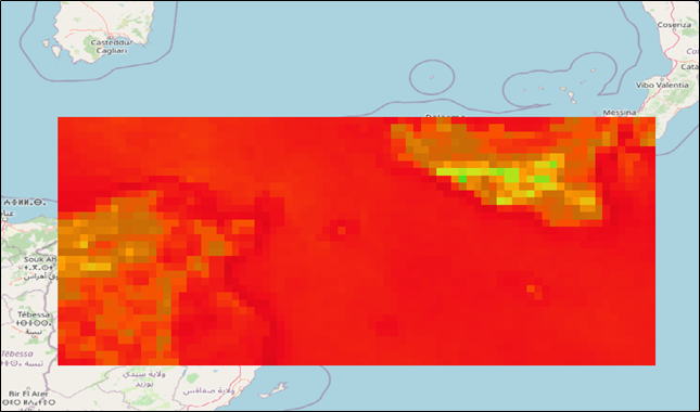
Example