Description
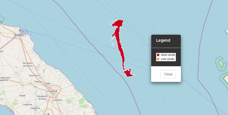
- Detection of oils in sea areas adjacent to the coast in order to generate alerts for potential beachings
Use case: triggering execution of beached oil characterization algorithms (product research CosteLab developed dl CNR-IMAA) - Method:
- This alert is the result of a semi-automatic operational chain and will be provided during the demonstration period of the project by identifying potentially stranding oil spills (proximity criterion with the coast) through the analysis of SAR data.
- For this alert, the operational chain will be used, based on the SEonSE platform of eGEOS , in external service mode provided by e-Geos
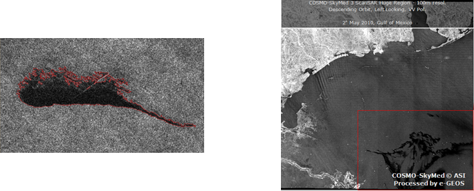
- The detected oil spill is segmented and characterized in terms of radiometric contrast and geometry
Operating scenarios
- Extraordinary monitoring
Technical specification
| Requirement | Product Description Offered |
| Spatial resolution | From 5 to 100 m (depending on the SAR data used for estimation) |
| Coverage area | From 1600 to 60000 Km ^ 2 (depending on the SAR data used for estimation) |
| Geographic accuracy | 15 m (geometric accuracy of the incoming SAR data) |
| Information Age | 1 day |
| Measurement uncertainty | 2 pixels of shape definition accuracy |
| Measurement / projection unit | Length / width: meters Area: m 2 Projection: Lat / Lon WGS84 |
| EO data in input | SAR data from COSMO- SkyMed , Radarsat-2 and Sentinel-1 |
| Input data used | Wind forecast from ECMWF or NOAA data |
| Given for validation | In situ data |
| Algorithm method | Automatic feature extraction for extension characterization |
| Format | Shape file |
| Refresh rate | Potential, given by the revisit of the sensor: 12 hours |
Example