Description
- Coastline digital map, obtained by automatic processing of VHR data (1 to 10 meter) and subsequent manual photointerpretation to enhance the result
- The map delivers a classification in homogeneous segments of the coastline
Operating scenarios
- Base knowledge
- Post event
- Extraordinary Monitoring
Technical Specification
| Requirement | Description |
| Spatial resolution | 1 – 5 m |
| Coverage area | Max AoI extension: 50km |
| Geographic accuracy | Circular Error 90%: <=1.5 pixel (1.5 times bigger than the spatial resolution) |
| Information Age | 5 years |
| Measurement uncertainty | 10% |
| Measurement / projection unit | Projection: UTM-WGS84 |
| Input EO data | – Hi-res optical data: Sentinel-2, Pléiades, GeoEye – Hi-res SAR data: COSMO SkyMed, TerraSAR-X, Sentinel-1 |
| Input data used | Not needed |
| Data used for validation | Ground truth or cartography supplied by the users |
| Format | GIS file: shapefile Metadata: standard ISO 19115, and compliant with INSPIRE 2007/2/CE and with Italian regulation “D.Lgs. n. 32 del 27/01/2010” |
| Refresh rate |
Example
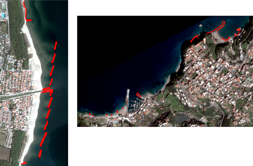
Right: Map of the coastal defense works in the Gulf of Naples (Sorrento peninsula), obtained using Pléiades images